
Waking up to a nice sunrise in a barren landscape below Donohue Pass a decision is waiting to be made: Shall I stick with Kevin’s “slower” pace or should I carry on alone?
I usually hike faster than he does, but also enjoy the resulting longer breaks. And of course he’s nice company! When we set out in the morning, I say Good Bye to him – just in case – we might not meet again.

However, we meet quite soon, when I reach a spot with cell phone service and make a call I wasn’t able to do at Tuolumne Meadows. Kevin catches up and during a short break he explains his hiking plans for the next days, which actually sound quite reasonable.
As I pushed him over Donohue Pass yesterday and he seems to have an upset stomach some shorter days don’t sound like a bad idea. And I’m already a day or two ahead of my original plan anyway.
After picking up my resupply package at Muir Trail Ranch in about a week from now I will have to reconsider my pace anyway.


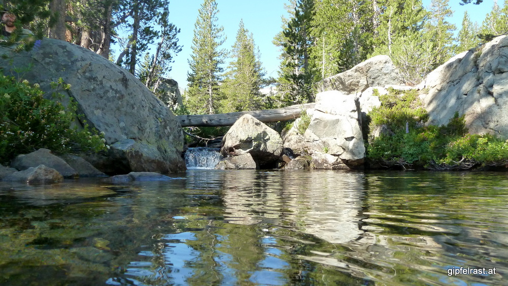
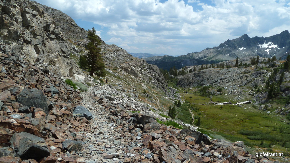
We walk down into a thinly forested area and pass some spots that would have been nice campsites. We cross many streams via logs that serve as bridges, we don’t have to get our feet wet.

Before we start the ascent to Island Pass other hikers warn us, that they have seen two bears in the area – a mother with her cub. This is the kind of encounter I’d rather avoid. Fortunately we don’t cross their paths and soon arrive at the top Island Pass.

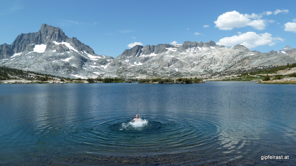
I’m a bit wondering why this place is called a pass. Technically it may be one but after a less than 200 m (600 ft) climb it feels more like standing on a very flat hilltop. But what’s more important: the view is great! Rugged mountains around us – Mt. Ritter and Banner Peak are looking down on us – and a couple of lakes.


Especially after spotting Thousand Islands Lake the agenda is clear: Get down as fast as possible and have a long break and a swim there!

For an elevation just shy of 3000 meters the water is surprisingly warm – or should I rather say un-cold?. So it is relatively easy to get into the water and to stay there for a while. Afterwards we lay downg in the sun to get dry again.

This is the first place since Tuolumne Meadows with a notable number of other hikers, but it is far from crowded. We realize that today is a Saturday and the lake is probably a popular day-hike destination. This is also the place where the Pacific Crest Trail and the John Muir Trail split for a about a day’s hike.

After passing a couple of smaller lakes we reach Garnet Lake. We have to hike around its eastern tip and cross the outlet on a nice wooden bridge – which is a nice deja vu: an older version of this bridge is featured on the John Muir Trail page in the English Wikipedia.


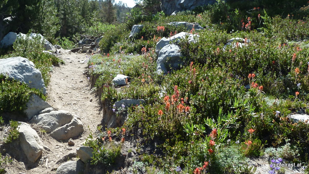
Before we can start a looooong descent to Shadow Creek, we have to overcome a short climb in the afternoon heat. As the path crosses a field of loose stones another hiker warns us that he thinks he heard a rattlesnake. So he advises us to cut some switchbacks to avoid the little rattler.
When we reach Shadow Creek both of us are already out of water so we stop to filter some from the river. As we are sitting there with our feet in the water some raindrops are falling. Not a big surprise, more clouds have been building up all afternoon. Soon we decide to hurry on to get to Lake Rosalie before it gets worse.
Just before we reach Shadow Lake there is some close thunder and it appears that a downpour from the dark clouds will start immediately. We leave the path to set up our tents to seek shelter from the rain. After we’ve done so, we realize that this is a part of the trail is a no-camping area according to the ranger at Yosemite Valley who issued our permits.

But it’s too late now, we decide to just wait out the rain and move on as soon as possible. The rain never comes (except a short drizzle) and the thunder slowly moves away. After 45 minutes we’re packing up again. Mr. Ranger will not know that we have ever been here. 😉
Now there’s only a final ascent of about 250 meters between us and Lake Rosalie. We decide to push up the switchbacks as fast as possible. At Rosalie Lake we camp with a fun group of four American hikers that we have been leapfrogging all day.

I’m too tired to prepare a warm meal, so I take a nap in my tent after eating only some chocolate and granola bars instead of a proper dinner. Tomorrow will be an easy day and we plan to camp at Red’s Meadow which means we will have one (or two) of their famous burgers there.
Distance hiked on JMT: 13.7 mi / 22.0 km
Elevation gained: 2600 feet / 800 meters
Time spent hiking (including breaks): 10:30 h
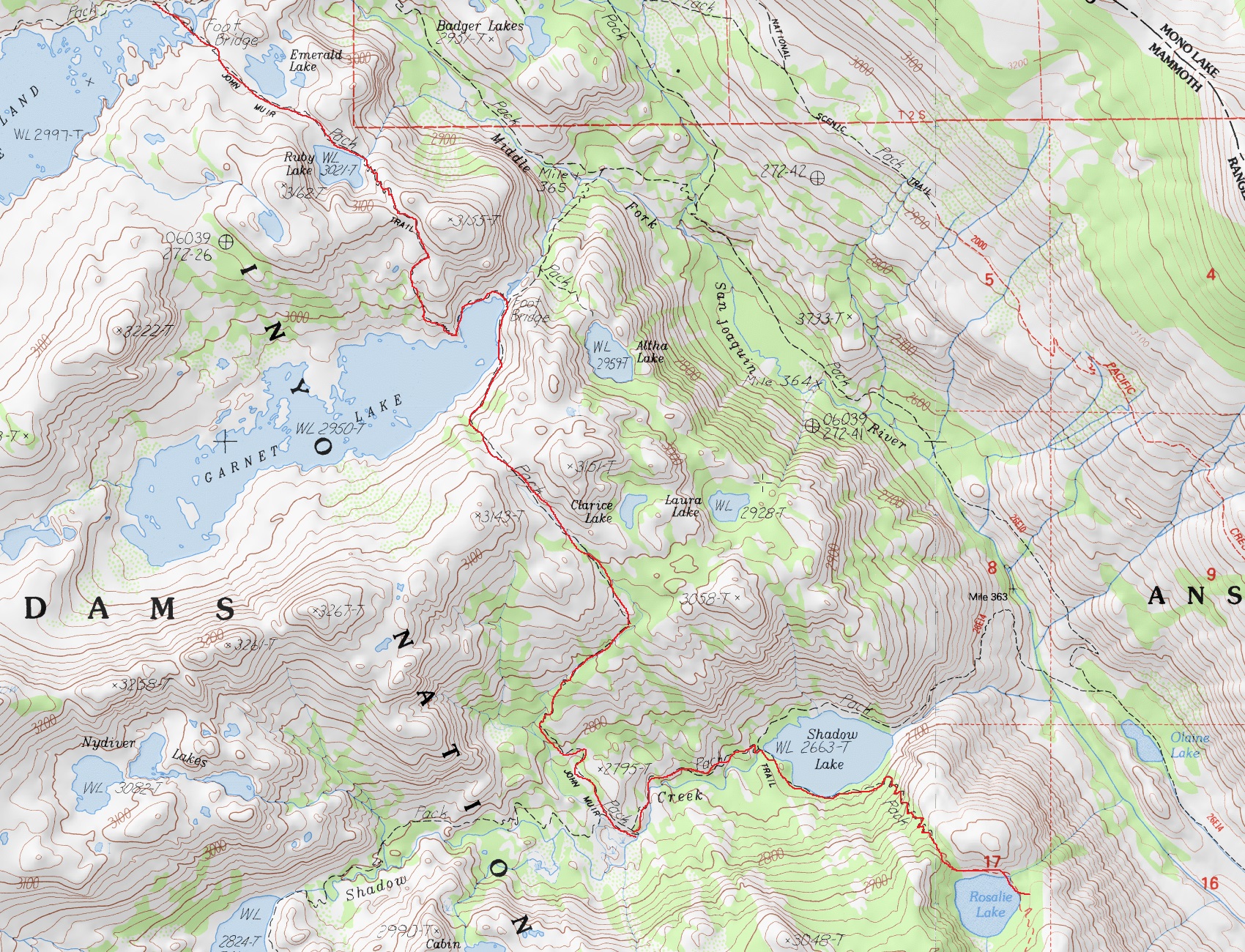
Maps of Day 6:

| <<< Day 5: Into the Wilderness <<< | Day 6 | >>> Day 7: In and Out of Red’s Meadow >>> |
Hallo Gert,
vielen Dank für die “Mitnahme” auf der Reise über die ersten 6 Tage des John Muir Trails. Ich warte schon immer gespannt auf die Veröffentlichung des nächsten Tages..
Da für 2014 der JMT fest geplant ist, erlaube ich mir einige Informationen aus Deinem Blog (gute Rast- und Lagerplätze usw.) in mein Kartenset einzuarbeiten.
Nochmals vielen Dank und Gruß aus Oberbayern –
Jörg