
A windy night is followed by a windy morning, so I pack up quickly and start hiking just as Rob, Peter and John begin to prepare breakfast.
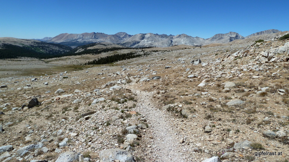
I have about 650 meters remaining to climb to Forester Pass. There is a lake half way up that seems to be protected from the wind.
There I cook my breakfast at one of the few tiny campsites so many hikers have aimed for yesterday. It must have been a bit crowded here, likely some of them were forced to go over Forester yesterday.


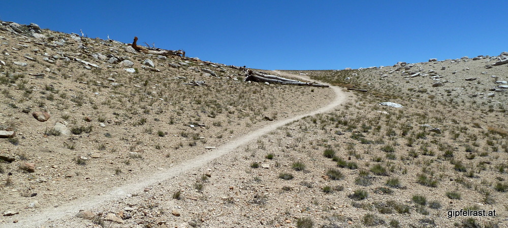
It is a really smooth uphill trail, I find it quite unbelievable that I am at an elevation close to 4000m. Back home in the Alps this would be much more alpine challenge with glaciers all around. No hiking in T-Shirts and trail runners 😉


During the ascent is the only time I encounter snow on the entire John Muir Trail. It’s just a little patch a few meters in size some steps off the trail.


After some final switchbacks, I’m finally there. The sign confirms it:
Entering Sequoia National Park
Forester Pass
Elevation 12.300 Ft.
And – what a view!
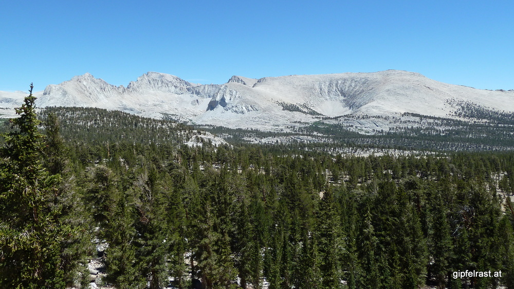
Sorry for keeping repeating myself, but the southern part of the JMT is absolutely breathtaking! Since Mather Pass everything appears to be getting bigger and bigger…

In the morning I thought Forester Pass would be the highlight of the day, but I was just wrong: To the south there is an endlessly wide basin literally dwarfing Upper Basin south of Mather Pass a few days ago.


On the pass there are a couple of familiar faces: Rob, Peter and John arrive not long after me, so does Frederick. There’s also Lars, one of the few German hikers I’ve met on the trail.

Frederick (the geology professor!) points out one of the peaks on the horizon: That’s Mount Whitney! Ah, finally!
Well, later in the day that peak turns out to be in a completely wrong direction. But here and now I trust the expert and take a lot pictures of alleged Mount Whitney.
In fact you cannot see Mount Whitney from Forester Pass at all.
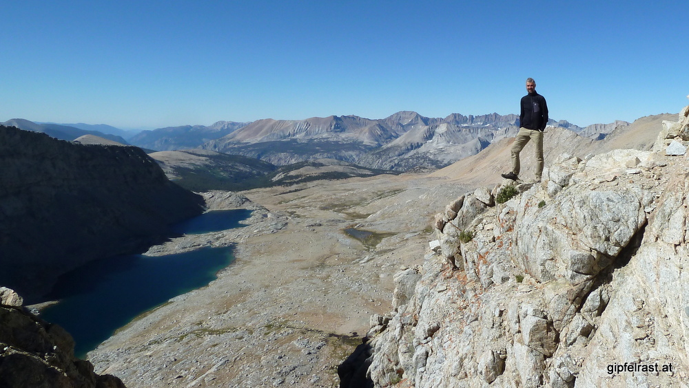
I stay on top of the pass for over an hour, it’s really hard to leave this place. From the south side a strong wind is blowing, but when you’re staying away from the small chute that funnels the air it is quite calm.

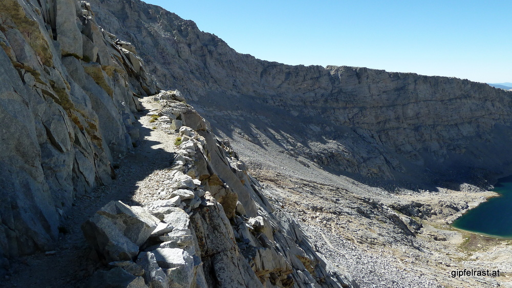
The trail on the southern side of the pass has been built into the rock wall, probably using lots of dynamite. Just below Forester I cross what is probably the most difficult part of the entire Pacific Crest Trail.
The PCT hikers that come here on their way from Mexico to Canada usually do so at a time of there when there still is a lot of snow. The PCT’ers have to cross a steep snowfield in early June, knowing if they slip they’re gone. For good.

But for JMTers, usually coming later in the year, this passage is easy. Today is the last day of July, no signs of any snow or other difficulties.
During the way down I take another break because I enjoy the view so much.

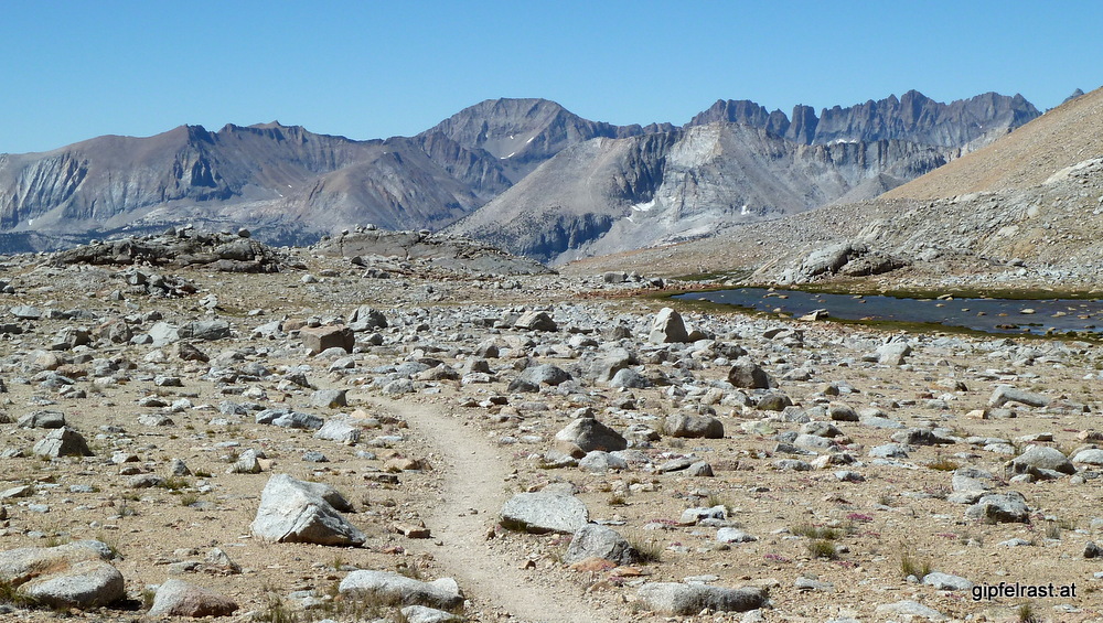
The many, many miles hiking out this wide basin are like nothing I’ve ever seen before. I really enjoy walking in this unique landscape.
At one point when I am – once more – sitting somewhere and gaze in awe at the scenery, Frederick catches up and with a simple sentence he expresses exactly what I’m thinking at that moment:
It’s big, huh?
Indeed, it really is!

When crossing Tyndall Creek, I reach another landmark of my JMT thruhike: the first signpost to Mt. Whitney! 16.1 miles, that’s already very close.
The last mileage to Mt. Whitney I saw was at the trailhead in Yosemite: two hundred something…


From Tyndall Creek it is a short (five miles) hike to today’s goal Wallace Creek. On the way there the JMT crosses another amazing place: Bighorn Plateau.


The lake would make a fine campsite as well.

When hiking the JMT southbound Bighorn Plateau is the first place where you can see Mt. Whitney – and this time it’s the real one 😉

At Wallace Creek I camp again together with Rob and his boys.
I could have easily continued today to Guitar Lake and then summit Mt. Whitney tomorrow. I’ve thought about it for a while, but then decided against it.
There’s only one drawback: I will arrive in Lone Pine on a Friday afternoon, and the next bus out of there will be on Monday morning, that means being stuck for the weekend in the little town.
On the other hand: I’m here to spend time on the trail, and not to catch a bus. And all the friends I have made on the trail want to finish on Friday, maybe we can reach the summit together…

As it turns out all my worries of not having enough food for the second part of my hike were in vain. While I see others already rationing their supplies, I have plenty left. In the evening I give some chocolate and granola bars to John and Peter and am rewarded with some really happy faces…
And I’m happy as well because my backpack just got a few hundred grams lighter. 😉
Distance hiked on JMT: 13.8 mi / 22.0 km
Elevation gained: 2300 feet / 700 meters
Time spent hiking (including breaks): 7:45 h (estimated)
Maps of Day 17:


