
After yesterday’s long day some short and easy hiking is very welcome. We only need to get over Cathedral Pass and then down to Tuolumne Meadows, which should be a matter of a couple of hours of nice walking.
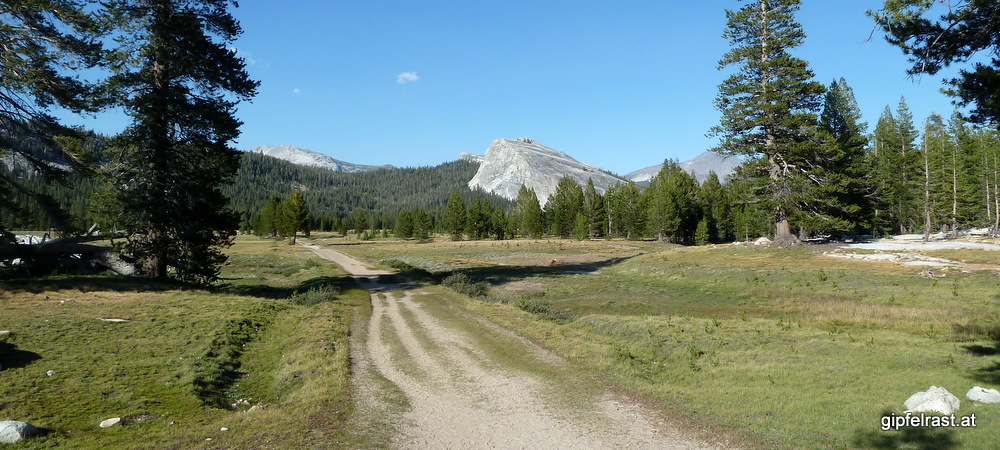
Having just reached the southern end of Long Meadow yesterday before camping we now continue north on this nice piece of grassland that definitely deserves its name.

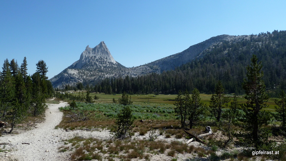
Soon the impressive-looking Columbia Finger can be seen in the north, we’ll pass by closely on its right side.

A short uphill later the John Muir Trail climbs above 3000 m for the first time – but stays below 10000 ft ;). When used to hiking in the European Alps this is an unusually easy terrain at such an elevation…

Now the descent starts, barely noticeable we cross our first pass at the end of a meadow: Cathedral Pass.
After passing the junction with the trail leading to Lower Cathedral Lake it gets a bit more crowded again. Day hikers are coming up from Tuolumne Meadows. Yesterday we considered this lake also for camping, but when arriving at Long Meadow our day was long enough already…

Just before reaching Tuolumne Meadows the path turns right and parallels Tioga Road for a while. At the Visitor Center I ask for directions to the backpackers’ campground and have an interesting conversation with the friendly Lady:
– Which trail are you hiking?
– John Muir…
– Really the entire trail?
– Yes, just started 4 days ago in the valley.
– Of course you must have just started – you look so clean!
But after four days on the trail with exactly zero showers I feel anything but clean …
At Tuolumne Meadows the 211-mile John Muir Trail has its only two road crossings as the “official” route runs for a short while on the other side of Tioga Road. But we follow the road directly to the campground to set up our tents.

My next goal is the Tuolumne Meadows Grill to have one of the famous burgers. After some days of trail food this is a welcomed change! And despite looking so clean I wash rinse my shirt (and a bit of myself) in Tuolumne River.

In the evening – after having another burger – Nick and Shenan want to hike the part of the John Muir Trail on the other side of the road – Nick apparently wants to hike every single mile of the JMT. As it promises to be a nice flat evening walk I join them.
Kevin doesn’t join us, he picks up his first resupply package at the Tuolumne Meadows post office.
During the evening walk we also pass by the intersection with the 4286 km (2663 miles) long Pacific Crest Trail which runs from the Mexican border to Canadian border. The JMT now takes a mostly identical route as the PCT just until a few miles before Mt. Whitney. I’m curious if we’ll see any PCT thru-hikers – although they should have passed this area already if they really plan to reach Canada before winter.


In the evening we have some beers celebrating our last camp together with Nick and Shenan – it was very nice meeting you! Tomorrow we will probably be camping on different sides of Donohue Pass.
Until now, we have been walking northeast, now the trail turns south for the rest of its course.
After four days I’ve now reached about mile 23 of the John Muir Trail (of a total of 211) but expect that number to grow significantly faster in the next days, as there are no side trips planned.
Distance hiked on JMT: 9.7 mi / 15.6 km
Distance hiked off JMT: 1.2 mi / 2.0 km
Elevation gained: 1000 feet / 300 meters
Time spent hiking (including breaks): 4:30 h (estimated)
Maps of Day 4 (red = JMT, blue = other trails)


| <<< Day 3: Half Dome! <<< | Day 4 | >>> Day 5: Into the Wilderness… >>> |